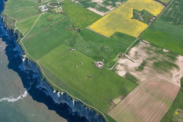
Bempton Chain Home Radar site included in new Historic England aerial photograph project


The Chain Home Low Radar area outside the village can now be viewed from above for the first time online.
Chain Home was the codename for the early warning radar stations built by the RAF before WWII.
Advertisement
Hide AdAdvertisement
Hide AdEarly Chain Home Low sites had separate transmitters and receivers, but after 1942 sites such as Bempton had the transmitter and receiver combined and housed in a single block with the aerials mounted on top.
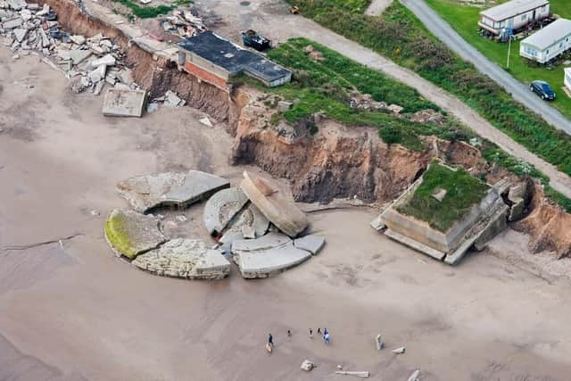
The First and Second World War battery at Fort Godwin, Kilnsea is also included.
Originally constructed inland, the receding coastline now means that some buildings are perched on the cliff while large parts are on the beach including one of the circular gun emplacements.
Historic England has launched an online ‘Aerial Photograph Explorer’ tool, making thousands of aerial photographs available to view online for the first time.
Advertisement
Hide AdAdvertisement
Hide AdMembers of the public will be able to search an online map showing aerial photographs of Yorkshire and the nation over the past 100 years.
The platform will allow people immediate digital access to Historic England’s nationally important collection of aerial photographs.
Around 300,000 of the photographs are the work of Historic England’s Aerial Investigation and Mapping team.
Established in 1967, the team takes photographs of England from the air to discover new archaeological sites, create archaeological maps and monitor the condition of historic sites across the country.
Advertisement
Hide AdAdvertisement
Hide AdThe remaining 100,000 images come from the Historic England Archive aerial photography collection, which numbers over two million images in total, and includes important historic photography, including interwar and post-war images from Aerofilms Ltd and The Royal Air Force.
By opening up these images to the public through this accessible online tool, Historic England hopes that people will use it to research their local areas, offering an insight into a century of changes and development.
Duncan Wilson, chief executive, Historic England, said: “I am delighted that our new online tool will allow people to access easily our wonderful collection of aerial images and enjoy the historic photography that our team uses every day to unlock the mysteries of England’s past.”
Visit tinyurl.com/2p8757sb to find out more details.
Click here to visit the site.