A Stroll With Stu: a beautiful walk from Commondale to Danby - thanks to Geology Trust leaflet
and live on Freeview channel 276
They follow some minor paths that are barely visible on the Ordnance Survey map and I suppose the notion of a public right of way may be questionable, but all are clear on the ground and are on open moorland so there is no obvious problem following them (any complaints though, should be directed to the producers of Jurassic Park).
It’s about five miles in total and I did this on Good Friday, a day after a 36 hour monsoon which left puddles galore, but was otherwise surprisingly decent, mudwise.
Advertisement
Hide AdAdvertisement
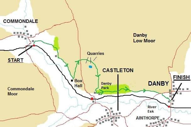
Hide AdI alighted the train at Commondale Station, thankful to leave behind a two-car train taking about 25,000 sardines to Whitby and running 30 minutes late due to managerial apathy.

Commondale station is always a delight.
Pretty and utterly rural, it is some distance from the nearest road and you leave by following a path up through a grassy field.
Go through a gate at the top and turn right on a wide track.
This snakes left then right, soon past some resident llamas, then through a stretch of woodland slowly coming alive with birdsong and greenery after months of winter sleep.
Advertisement
Hide AdAdvertisement
Hide Ad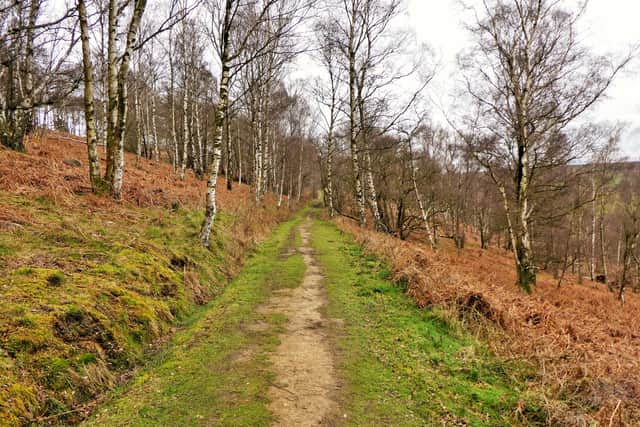
After the woods, pass a farm and continue on the wide, undulating path, noting that Commondale Beck down below supports expanses of wild daffodils to rival Farndale.
The next farm along the track is Box Hall where it is time to take a geological diversion.
Adjacent to the main building, head left on a grassy path straight uphill, keeping the moorland brook close by on your right.
Keep climbing, past a lone and hardy tree away to your right, but do remember to pause a while to take in the stunning views that the climb has revealed behind you.
Advertisement
Hide AdAdvertisement
Hide Ad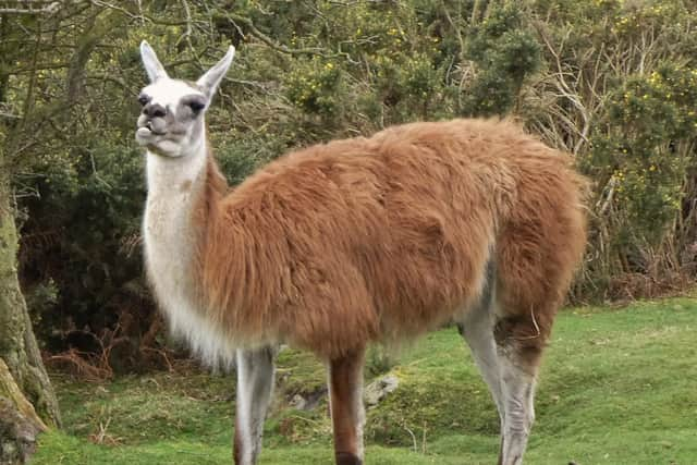
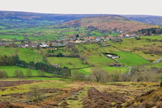
Westerdale is in the far distance, Eskdale curls away to your left and the valley of Commondale Beck on your right, supports the path along which you’ve just walked.
A little more climbing leads you to the road above Castleton.
Cross over, and skirt around a gate onto a wide path heading towards nowhere.
There are abandoned quarries all around, largely worked for something called Sugarstone.
Advertisement
Hide AdAdvertisement
Hide Ad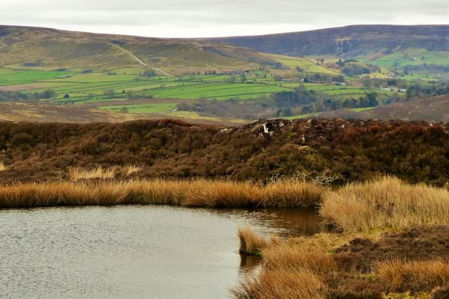
This is a super hard quartz that was widely used in the steel industry for lining furnaces due to its exceptionally high melting point.
They used it to make moulds at foundries and similar stuff was even used in the tiles on the heat shield of the Space Shuttle, though I doubt if the procurement manager at NASA popped over to Castleton for a recce.
The stone was lowered down an incline – we’ll come to that soon – to the valley floor where it was crushed into something that presumably resembled sugar, before being carted off to the burgeoning iron and steel making cities in the North of England.
You’ll soon pass a large pond on your right, an infinity pool for any resident frogs with scandalously wonderful views across the valley as they rest on the western lip of the water sipping a cocktail and chatting about the weather.
Advertisement
Hide AdAdvertisement
Hide AdCarry on along the thinning path through a short gulley, bending right to reach the top of that steep incline heading in a straight line down the valley side.
There are bits of old sleepers, metal fixings, huge drainage ditches on either side and all in all it is an impressive sight in a stunning bit of countryside that I didn’t know existed.
My thanks go to the Geology boys and girls who wrote the leaflet.
Halfway down the hill at a concrete slab, the path becomes a little jumbled.
Advertisement
Hide AdAdvertisement
Hide AdBear slightly right to go through a gate, skirting an enclosure to reach a clear grassy path that drops down to meet a wide track.
Turn left to follow the familiar track through Danby Park birch woods, for a mile or so, emerging through a gate onto open land where you go straight on, dodging puddles, to eventually drop onto the road.
After a short distance along the road, just after it curls left and dips downhill, take a signed path on your right that soon works its way into Danby Village not far from the Railway Station.
From here you can make a choice.
To your left, the lovely Stonehouse Bakery and café alongside the equally lovely Duke of Wellington pub.
Check the opening times and if they are closed, the reliably open Fox and Hounds will welcome you a mile up the road on your right.