
A Stroll With Stu: try this five-mile East Cleveland circular route which features 'best beach in north east'
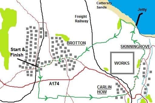
Brotton, Carlin How and Skinningrove are unlikely to feature in any holiday brochures, but there is industrial heritage, a nature reserve and the best beach on the East Coast to enjoy on this five-mile circular route starting outside Morrisons on Brotton High Street.
Head uphill, cross over and take a sharp right along Child Street, soon bearing left and crossing a stile with the local hospital up on your left.

Not far along the path, a second stile leads across grass to an elaborate footbridge over the A174, which must have taken a tidy chunk of the construction budget for Brotton bypass.
A hundred yards further on, turn left along an obvious track, rising slowly and ultimately taking you all the way to Carlin How.
This is part of the Cleveland Street trail, a nine-mile route from Guisborough to Loftus that was probably developed by the monks at Guisborough Priory, who enjoyed a good stroll.
Passing through or near Slapewath, Kilton and Skinningrove, this will have looked a whole heap different 150 years ago.
This was the heart of the East Cleveland iron industry with mines, railways, smoke and noise in abundance.
Today, I was blessed with the sound of skylarks, the eye-catching flutter of early butterflies, the dull hum of a nearby wind turbine that looks like it could power a small city, and the increasing commotion from the steelworks, which from this footpath look 10 times bigger than I imagined.
It’s reassuring I guess, that all the abandoned ironworks in the area gave birth to this modern steel plant.
I visited the place when I was Health & Safety Manager of the Rail-freight Company that keeps the heavy stuff off the roads.
One of our locos had hopped off the rails and died, and I figured I’d get some brownie points from my boss if I turned up at 2 in the morning to watch the Engineering pit-crew strutting their stuff.
I donned a safety hat and a hi-viz bib and enthusiastically joined in with some head-shaking, though I kept well clear of any actual work, largely because I had no idea what was going on.
An hour or two of nudging with some industrial jacks, liberally supported with some industrial language, and the job was a good ‘un.
(I brought nothing to the party to be honest, but in fairness to myself I was sharper than any of them when it came to filling in an expenses form).
With the field boundary on your left, the path drops down to a back lane in Carlin How.
Carry on past the chippy and cross the A174, heading straight down Mount Pleasant Road.
Pass the entrance to the steel works, and soon bear left to approach the striking St Helens parish church, with its prominent roof tower.
Built impressively in red brick in 1900, the foundation stone was laid by one Mrs Dorman, who I’m shrewdly guessing might have had something to do with Dorman Long steelworks.
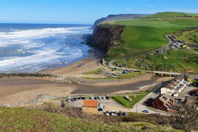
Skinningrove village is down in the valley on your right, and as you head seawards, wonderful views develop across the little town to the cliffs and a stormy North Sea beyond.
A cold northerly had whistled down from Spitsbergen, and the sea was alive with crashing breakers.
Stay right on open ground to admire these views, but then bend left to reach a gulley that leads directly to the pier beyond.
(Doesn’t take too much imagination to work out that this was likely a railway incline taking heavy stuff up and down from the works to the jetty).
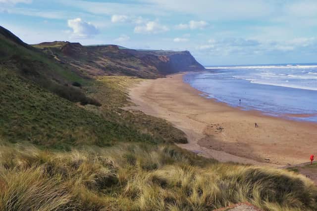
Some steep steps on your right will get you down to sea level, where you should turn left and allow your eyes to feast on the beauty of Cattersty Sands.
With a beach like this, it is a mystery why Skinningrove hasn’t developed like Saltburn and Staithes for days out on the North Yorkshire coast.
After 100 yards on the sands, clamber up through the dunes to find a lateral path heading right and ultimately climbing up steps, on a nosebleed inducing ascent to the Cleveland Way cliff top path.
At the top of the last flight of steps, turn right and after a few hundred yards head inland towards a notice board showcasing Cattersty Gill nature reserve.
Just ahead of that board, climb a stile on your left to follow a path which, with the aid of further stiles, eventually curves right under the freight railway to Gripps Farm and its muddy pigs.
Go straight on along a grassy path after the farm, and after a short climb you will emerge onto the road into Brotton close to the Green Tree pub.
From there it is half a mile downhill (past some imposing houses that betray the area’s rich past) back to your start point.