
Historic Towns Trust to publish new map revealing Scarborough’s past
Featuring highly detailed cartography, the unique story of Scarborough’s urban history and related topography is to be illustrated via a new expansive multi-period map, currently being developed by The Historic Towns Trust.
The authoritative map will include the town’s lost medieval and later period buildings, cemeteries, earthworks and sites of historic interest in addition to those that remain, which both offers an insight into how Scarborough developed over past centuries and why it appears as it does today.
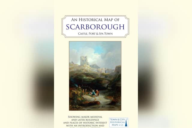

Based on the Ordnance Survey map published in 1912, The Historical Map of Scarborough will also feature a comprehensive gazetteer on the reverse side, highlighting all the town’s significant heritage sites from across its 3,000-year history.
Project coordinator and historic buildings specialist Chris Hall is leading a small team who are developing the map contents.
Mr Hall said: “The Historic Towns Trust maps are very highly regarded.
"Coming up to Scarborough 400 it is appropriate that the town has been chosen for the first map of a seaside resort and I am excited to be part of this project”.
The Historic Towns Trust is a national charitable organisation that collaborates extensively across the UK with local historians, archaeologists and geographers to publish educational maps and atlases.
Resources Committee chairman James Winterbotham for the Trust said: “This will be a worthy addition to our stable of historical maps.
“It will highlight the significant heritage of Scarborough’s urban landscape, inspire pride in the town and sit at the centre of some exciting educational and community projects.
"We are fortunate to have a brilliant team working with us on this project and grateful to them for their efforts which are entirely voluntary”.
Leading the Scarborough initiative is former City Archaeologist for York John Oxley MBE and a co-director of Big Ideas By The Sea festival who said: “I was delighted when The Historic Towns Trust took part in the Big Ideas By The Sea festival in May this year.
"We always thought that a map of Scarborough would be a really big idea to celebrate Scarborough 400.
"We need your support to make this happen so please go to the HTT website and support this project with any donations you can make”.
The planned scheme, which has been the subject of discussion for several years, will culminate in the map’s scheduled publication in the autumn of 2026.
The initial fundraising target had originally been set at £15,000 for printing.
An additional £10,000 is being sought to fund both community work and engagement with Scarborough schools.
Potential sponsors of the project who may like to consider assisting are asked to visit shop.historictownstrust.uk/product/donate with all donations received from UK taxpayers being eligible for GiftAid.
The Historic Towns Trust’s other Yorkshire maps feature Kingston-Upon-Hull, Beverley, Ripon, York and Bradford with others nationwide in the series that includes Chester, Oxford, Cambridge, Bath, Winchester, Ipswich, Coventry, Perth and London.
Visit historictownstrust.uk for further information.