
Storm Benjamin causes weather warnings across Scarborough, Whitby and Bridlington for 70mph winds and heavy rain
Two yellow weather warnings for rain and wind have been issued by the Met Office as Storm Benjamin is set to batter the Yorkshire coast this week.
Strong winds may cause travel disruption and some damage across eastern England during Thursday, and there is a risk of heavy rain.
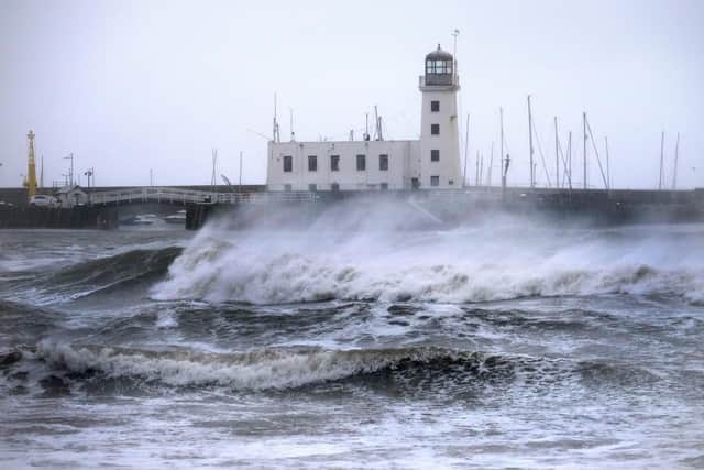

Both warnings cover the Yorkshire coast, including Scarborough, Whitby and Bridlington.
The wind warning will be in place most of the day tomorrow (October 23), from 9am until 11:59pm. The rain warning will similarly be in place for most of tomorrow, from 12am until 9pm.
Road, rail, air and ferry services could be affected, which could cause longer journey times or cancellations.
There is a slight chance of some damage to buildings, such as tiles blown from roofs, and flooding of homes and businesses could happen.
Power cuts may occur, with the potential to affect other services, such as mobile phone coverage.
There is a small chance that injuries and danger to life could occur from large waves and beach material being thrown onto sea fronts, coastal roads and properties. The Met Office have said: “Storm Benjamin is expected to cross the south of the UK later Wednesday and early Thursday; confidence in its track has improved compared to yesterday but still remains lower than usual for this type of weather system which leads to continued uncertainty over the corridor of highest rainfall totals. “That said, an extensive and in places heavy swathe of rain will move into southwestern Britain later Wednesday and spread quickly northeast, with totals by early Thursday morning of widely 20-30mm, and for some places 30-50mm. There is a chance a few places could exceed this, most likely over North Devon and Cornwall and also within a broad area encompassing Lincolnshire, Humberside, East Anglia and East Midlands. “In association with the rain, conditions are expected to turn windy with gales, initially along south-eastern coasts, but more widely across southern Britain during Thursday daytime. “As Storm Benjamin then moves across the southeast of England, stronger northeast to northwest winds are likely to develop. Gusts of 50-60 mph are probable quite widely, with 65-70 mph possible near coasts. There is a smaller chance, should Storm Benjamin be at the stronger end of expectations, that wind gusts in excess of 70mph could develop for a time very locally, this most likely late morning and into the afternoon. “There remains considerable uncertainty over the precise track and intensity of Storm Benjamin, which will significantly impact the details at your location. Near to its centre, a marked lull in winds is likely even during the period of this warning, with a sharp increase then occurring as the centre moves away northeast.”
Visit https://weather.metoffice.gov.uk/warnings-and-advice/seasonal-advice/your-home/stay-safe-in-a-storm for further advice.