Your Day Out:


Start from Goathland’s church, and cross the road to pass through the gate beside the Mallyan Spout Hotel. A sign indicates ‘Mallyan Spout’.
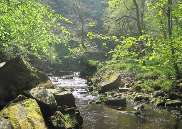
Follow the route downhill into the wooded valley. Through woodland glades, one soon glimpses shafts of sunlight filtering through the trees. Reaching the scintillating, bubbling waters of West Beck, turn left as signed to Mallyan Spout.
Advertisement
Hide AdAdvertisement
Hide AdReaching the waterfall surrounded by trees, admire its impressive thundering 70ft fall or more. It’s a shimmering cascade after heavy rain. Take care beyond the waterfall, as the stream path may be slippery as you proceed over footbridges, a stile and some steps. About a mile further, access the Egton Road.
Here, turn left along the road to ascend the hill. Stop where the road elbows left. Leaving the road go right through a gate to follow a bridleway. Go left down a path and cross a bridge to head beside buildings. Pass through a gate and continue across a field. While traversing this field, you enter a waymarked gate into woodland on your right.
The stony track ascends to a gate. Pass through and shortly turn right up the field beside walling. Next, you reach a gate fronting you as you leave the woodland. Go left at the top of the field through a gateway. Proceed with walling to your right. Enter a waymarked gateway seen in the wall.
Walk up the next field and you’ll discover your exit via a gate onto a metalled lane. Turning left along the lane, pass through a gate to follow the Roman Road sign. Enter two more gates by the farm, and keep to the public bridleway signs as you meet a green lane.
Advertisement
Hide AdAdvertisement
Hide AdMore handgates, a descent to a further gate and stile to negotiate and then walk onwards to reach a ford.
Crossing the ford, keep straight ahead along a gated track. Eventually, reach a road by farm buildings. Turn right up the road seeking a left turning onto a green track. This track leads up the hillside. You’ll observe Hunt House Road soon runs roughly parallel to your route.
Look out for red grouse as they nest on the moorland. They feed on young heather shoots. Sheep grazing helps to keep the heather short, and land owners use controlled burning to get rid of old, leggy heather stems. This doesn’t harm the heather roots or the peat.
Veer right towards a small cairn on the ridge. Then veer left to keep below and parallel to the ridge of rocks.
Advertisement
Hide AdAdvertisement
Hide AdTake a left fork by another cairn so that you walk slightly downhill to join an open track.
Before long and all too soon you’ll view Goathland and your ramble’s end. Passing a public bridleway sign, drop down to the road near the church. This returns you to your departure point.
Distance: 4.5 miles.
Refreshment: Several places in Goathland itself including inns. I suggest taking a flask etc on the walk.
Access: Goathland is eight or nine miles south-west of Whitby. Park at the west side of the village near the church.
Advertisement
Hide AdAdvertisement
Hide AdMap: This is a rough guide only. I suggest for more detail the Ordnance Survey Outdoor Leisure. North York Moors Eastern Area. Scale 2.5 inches to One mile.
NB In late summer, familiarise yourself with heathers in bloom, eg ling heather, bell heather and cross-leaved heath.
Warning. There may be a wet, slippery path beyond the waterfall after heavy rain.