Your Day Out: Visit Little Switzerland


Private transport is essential to access Langdale End, about nine miles due west of Scarborough. The stunning scenery, driving through Scalby village and Suffield, into picturesque Hackness must be some of the finest in North Yorkshire. From Hackness your route is well signed, turning right at the road junction along Broxa Lane.
The lime-rich soil gives good arable and pasture land at low levels, but the hilltops have been extensively planted with conifers and broad-leaved trees. You’ll discover a landscape of wide-open spaces and intimate valleys that delight walkers!
Advertisement
Hide AdAdvertisement
Hide AdRounding the bends you enter Langdale End, with St Peter’s Church to the left and a fine view of Howden Hill ahead, fondly known by the more romantic name of Sugar Loaf Hill!
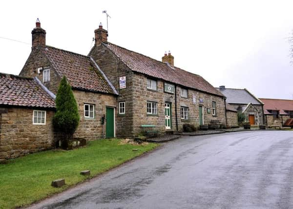
I suggest parking anywhere convenient in the village, taking care not to cause inconvenience to residents. Most walkers tend to park in a small car park near the bridge. Walk by St Peter’s Church to Moorcock Inn. It’s extremely popular with its tea room, bar meals, beers, wines and spirits. It’s believed to date from 1640 when it was a farmhouse. Here is a fine example of a Long House. In these traditional houses, one portion was used for family living, with another part, usually separated by a corridor, used to keep animals, feed and hay. This type of house was usually one room deep. Any extension would be made by adding a room at either end.
Ada Martindale was a former landlady and aunt of Maud Martindale who ran the pub for 26 years and became a legend in her time. That’s another story!
Leaving the Moorcock Inn, turn left to admire the village. It’s surrounded by steep wooded, and grassed hillsides, including Howden Hill. This small conical hill is a marvellous example of an outlier. All the bank sides in this area are steep because a cap of hard rock rests on top of bands of soft rock that are being eroded. The cap of hard rock has survived, while all around it has been worn away, so the hill is an outlier or survival.
Advertisement
Hide AdAdvertisement
Hide AdImmediately beyond the inn stands the Wesleyan Methodist Chapel dated 1822, and rebuilt in 1901. A gentle rise leads to White Lodge, and then a steep ascent leads to the monastery of St Athanasius off left. Halt! Here, go right as signed to Birch Hall, along a lovely lane providing a bird’s eye view of the spectacular scenery. The lane, banked and hedged to the right, becomes more of a track with mixed woodland either side. Continue, as far as a bright yellow sign: ‘No through road to Fylingdales...’.
From this point, walk straight ahead briefly along West Side Road for approximately 50 yards, seeking off left a bridleway sign. Here, leave West Side Road and turn left to follow a public bridleway cutting diagonally through the forestry in a south-westerly direction. This short, wooded section is only about one-third of a mile before opening into a lane near Birch Hall.
Turn left away from Birch Hall. Cross a road bridge, and a steep ascent beneath trees soon opens out into meadowland, with post and wire fencing to the right. Sheep grazing provides a peaceful scene as you re-join the lane junction, and continue your return route to the Moorcock Inn and your departure point.
Distance: 3.5 miles from St Peter’s Church, Langdale End, to the nearby car park.
Advertisement
Hide AdAdvertisement
Hide AdTerrain: Mostly good, easy walking. Boots in woodland recommended.
Refreshment: Only the Moorcock Inn when open. Otherwise inns, cafes or restaurants in Scalby and Newby en route.
Map reference: Explorer Map, Ordnance Survey OL27. North York Moors eastern area. Scale 2.5 inches to 1 mile.